London Heathrow Airport (LHR)
Driving Directions / Travel by Car
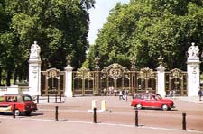
(London, England)
London busiest and most well-known airport, London Heathrow International Airport (LHR) can be reached from a number of directions. Located on the western side of the city, Heathrow is easy to reach by road, with the speedy Heathrow Express bus connecting the airport with central London.
Heathrow Airport stands to the east of the M25, north of the M3 and south of the M4 motorways. Prominent locations close to the airport include Hounslow and Wandsworth to the east, Spelthorne and Staines to the south-west, Colnbrook to the west, and Slough and Maidenhead to the north-west.
Areas of interest close to London Heathrow Airport include the vast and spreading Richmond Park to the east, which is known for its herds of free-roaming red deer and fallow deer. Also nearby, Windsor Great Park is located to the west of Heathrow and is an important area of countryside, stretching between Windsor Castle and Ascot.
Directions to London Heathrow International Airport (LHR) from the city centre:
- The airport is located to the west of central London and is 12 miles / 19 km from the very heart of the city
- Heathrow Airport is well sign posted from all nearby motorway connections
Directions to London Heathrow International Airport (LHR) from the M4 and M25:
- Terminals 1, 2 and 3 - leave the M4 motorway at Junction 4
- Terminal 4 - leave the M4 motorway at Junction 3, or Junction 14 on the M25 motorway
- When travelling to London Heathrow Airport (LHR) during rush hours, be sure to allow extra time for possible road works and traffic congestion
London Heathrow Airport (LHR): Virtual Google Maps
